If you own a digital device, it’s safe to assume you used Google Maps at least once in your life. According to Google Play, the Maps for Android devices has been downloaded 1,000,000,000+ times, which is just one fact showing how popular they are.
Here are other amazing facts that show the popularity of the app described during SMX West 2017 Day 1 conference:
- Google Maps has over 1 billion monthly users
- Users of Google Maps navigate over 1 billion miles every day
- 1 million third-party websites use Google Maps APIs
- Google Maps provide panoramas for more than 10 million miles of roads.
Impressive, right? But how does Google create such accurate, detailed, and easy-to-use maps for an entire planet? Who maintains and updates the maps? How does the company collect so much data? And what about those areas that cannot be accessed by cars with cameras?
In this article, we’re going to give answers to these questions and provide you with some surprising facts about Google Maps.
How Did Google Collect So Much Data?
Satellite, aerial, and street-level imagery weigh over 20 petabytes, which translates into about 21 million gigabytes, or 20,500 terabytes.
Google started the maps by using offline information. For example, it includes business names, street names, highway networks, road signs, and other information. This information was combined and published online to ensure that everyone with an Internet connection could access it.
The company worked a lot to collect the rest of the information needed to make the maps into what they are today. For example, it has a fleet of vehicles around the world to take 360 panoramas and help people to see the world without leaving their home.
“I use Google Maps every day,” says Donovan David, a programmer. “For my sons, they are the ultimate source of information about local businesses, even professional writing services.”
The satellite view is the result of a close collaboration with Google Earth developers. They stitched the photographs of the planet taken by satellites and cross-checked them with maps data to ensure the accuracy of the information.
Google doesn’t own all the satellites providing the data. In most cases, they are the property of third-party companies, both government and private.
How Does Google Handle Private and Inappropriate Content?
Naturally, a lot of privacy concerns arise when shooting the images for panoramas. For example, not everyone wants to have their face seen by users viewing the area. Also, the cars equipped with cameras often encountered elicit acts that could be interpreted as violence and crime and even funny things like bicyclist towing his stuffed penguin.
First, private content. Google uses a special automatic face and license plate blurring technology to protect the privacy in Street View as commanded by privacy guidelines.
 The automatic blurring of faces
In some cases, Google takes privacy to the next level. For example, users of the maps were able to find a cow with a blurred face. The picture quickly became viral on social media and started a lot of jokes about Google respecting the privacy of cows.
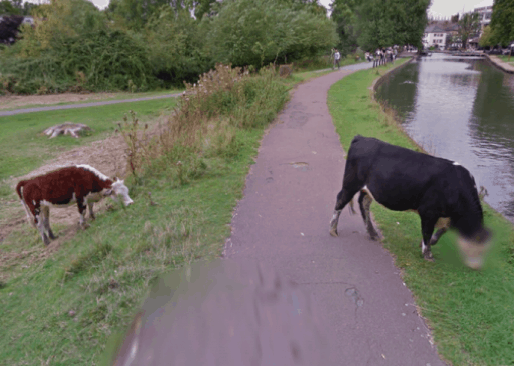 A blurred cow’s face that became an Internet sensation
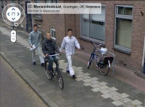
Second, inappropriate content. Over the years, Google has accumulated some illegal acts that were caught on camera during the process of capturing the panoramas. For example, a 14-year-old boy from the Netherlands was robbed in the middle of the day, but the police were not able to find the criminals.
Six months later, he saw the photo below of himself and two perpetrators on Google Street View and contacted the police. They sent a request to Google and used its archives to access unblurred photos and identify the suspects.
How Does Google Handle Incorrect Information?
The technology of capturing street views and some maps data is not perfect, so Google lets users report inaccurate information, a privacy problem, or other mistakes.
Every user of Google Maps can make an edit by clicking on an appropriate menu item.
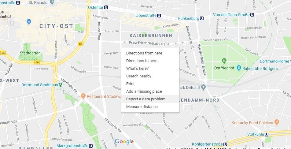
Then, Google uses its map-editing app called Atlas to review the reports and revise the maps if necessary. Most of the changes are made by hand.
Google Maps is a never-ending, continuously developing project that receives lots of feedback from users, so developers are busy making changes on a daily basis.
How Does Google Collect Data and Shoot Street Views in Places Inaccessible to Vehicles?
In addition to vehicles, Google has a large fleet of snowmobiles, trolley, bikes, and trikes to capture inaccessible places like stadiums, parks, and college campuses.
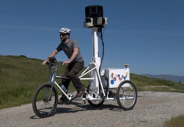 A Google Trike operated by a Google Employee. Credit: Google
They allow Google to create stunning views and detailed maps of places with poor road conditions and remote places.
Conclusion
Managing the best maps in the world requires a lot of work and sophisticated technology. Already, Google achieved amazing results with its maps and looks to improve them even more. This means new exciting features and opportunities ahead!