

In the ever-evolving world of digital tools, Google Maps Satellite View has emerged as a transformative resource across multiple fields. Whether you’re a traveler planning a remote getaway, a real estate agent evaluating properties, or a researcher studying geographic phenomena, the satellite view on Google Maps opens up a new layer of information that was once difficult, expensive, or even impossible to access. What was once a luxury for cartographers and governments is now accessible to anyone with an internet connection.
This vivid, bird’s-eye perspective of the world combines the power of geography, data visualization, and user interactivity in one interface. Let’s dive into the top uses of Google Maps Satellite View for three major sectors: travel, real estate, and research.
Travel: Planning Smart and Discovering More
For wanderlust-driven travelers, Google Maps Satellite View is more than just a navigation tool—it is a virtual scout that can reveal a destination’s character long before your bags are packed.
1. Scouting Destinations
One of the first things many travelers do when planning a trip is to search the visual terrain of their destination. Satellite view allows users to quickly get a sense of the area, including its natural features, proximity to landmarks, and overall layout. Want to know how lush that island is or how crowded that beach might be? Satellite imagery paints a vivid picture.
For example, before booking a stay at a Bali retreat, a user can zoom in and observe if the property truly sits near a peaceful forest or if it’s actually beside a highway. This kind of visual validation reduces disappointment and allows for better travel planning.
2. Analyzing Accessibility
Another practical benefit is reviewing the ease of access to remote locales. Satellite view lets travelers trace access routes, see the quality of connecting roads, and identify nearby infrastructure such as train stations, airports, or ferry terminals.
3. Previewing Hiking and Trekking Trails
Adventure enthusiasts use satellite imagery to map out hiking or biking trails over rugged terrains. For example, a trekker planning to climb the Dolomites in Italy can chart the topography and forest density, improving safety and experience.

Real Estate: Valuing Land and Location
In real estate, location is everything—and with satellite imagery, buyers and agents can now virtually inspect surrounding areas without stepping out of the office or home. This has become a major factor in the efficiency and accuracy of property evaluation.
1. Evaluating Neighborhood Quality
Before physically visiting a site, prospective buyers or investors can assess the general layout of a neighborhood. Are there parks nearby? How close are the commercial areas? Is the nearby land under development, perhaps signaling future value increase or construction noise?
Google Maps Satellite View showcases nearby schools, supermarkets, green spaces, and industrial zones, helping buyers make informed decisions based on surroundings rather than just the property itself.
2. Identifying Property Boundaries and Land Use
For larger properties, especially commercial or agricultural land, satellite imagery gives a clear overhead view that often allows users to approximate the size and layout. This can also help identify unregistered encroachments or illegal construction.
3. Monitoring Ongoing Construction Projects
Developers and investors frequently use satellite view to monitor progress on large developments. For regions with periodic updates, it becomes easier to track construction status, land clearing, and road creation without a site visit.

4. Virtual City Comparison
Planning to invest in an overseas property? A quick comparison between neighborhoods in different cities via satellite view can offer quick insights without needing local contact. It’s like touring the entire world from your laptop screen.
Research: Gaining a Geographic Perspective
Academics, environmentalists, cartographers, and analysts often rely on Google Maps’ satellite functionality to view geographic patterns, track environmental changes, and study land use transformations.
1. Environmental Monitoring
Satellite images are instrumental in mapping deforestation, wetland reduction, agricultural expansion, and other ecological changes. A researcher might use historical satellite imagery to track how an Amazon rainforest region has degraded over the last 10 years.
By enabling layer overlays and timelines, Google Maps empowers researchers to draw informed conclusions—an essential part of policy planning and advocacy.
2. Urban Development Studies
City planners and geographers use satellite data to examine levels of urban sprawl, transport networks, and zoning issues. This is especially useful in rapidly developing countries where city growth is less regulated. Comparing satellite impressions from different time periods yields insights that traditional land surveys can’t always provide quickly or economically.
3. Disaster Response and Planning
In times of natural disaster, timely imagery offers emergency services a crucial view of affected areas. Satellite imagery can map flood zones, destroyed buildings, and impassable roads—significantly improving response efforts.
Additionally, researchers use these views to improve future urban planning so that cities can become more resilient to disasters. This integration of data helps both in recovery and prevention.
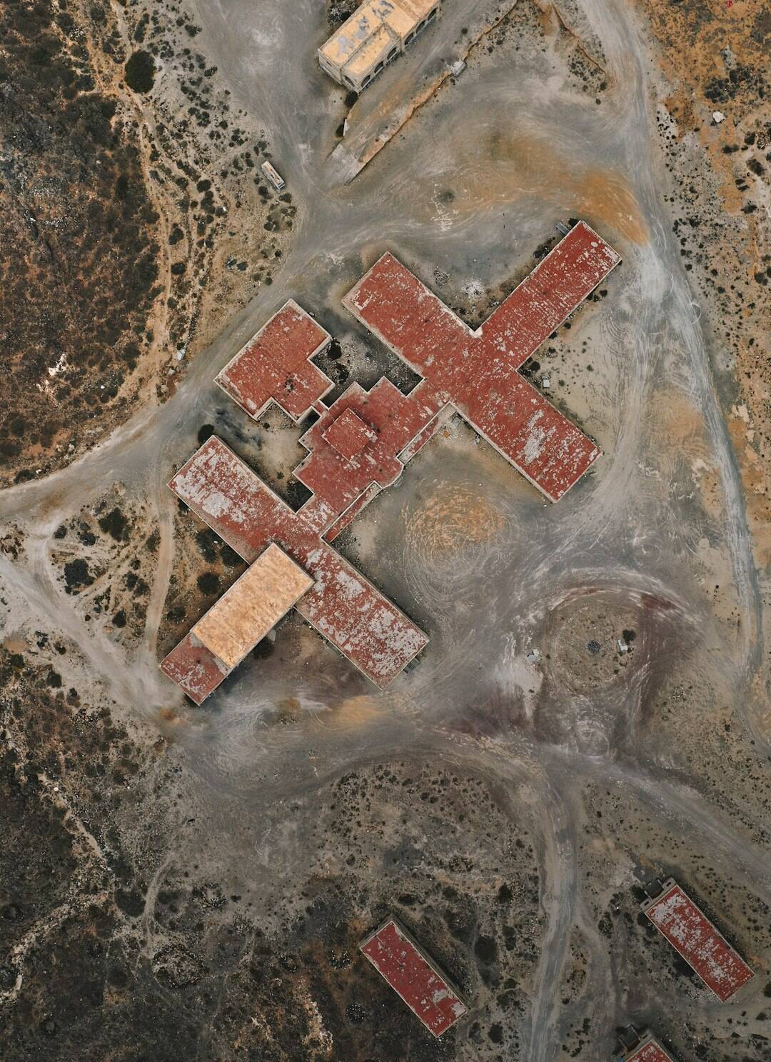
4. Archaeological Discovery
Another captivating use lies in archaeology. Satellite images have led to the discovery of ancient roads, city layouts, and lost ruins that are otherwise invisible at ground level. Aerial patterns seen in deserts or jungles often give clues to past human habitation.

Google Maps Satellite View: Limitations and Tips
While extremely powerful, satellite view does have its limitations. The imagery may not always be completely current. In rural or less-developed areas, images might be years old, which could be misleading for rapidly changing environments.
To make the most of Google Maps Satellite View:
- Zoom in and out to compare neighborhood detail and broader landscape context.
- Use other map layers such as “terrain” or “street view” alongside satellite for multidimensional insights.
- Refer to the image date shown at the bottom of the screen to judge accuracy.
- Combine with local knowledge or reviews to avoid drawing incomplete conclusions solely from visuals.
The Broader Impact
The accessibility of satellite imagery has democratized access to geographical knowledge. Instead of relying solely on topographic maps, specialists and everyday users alike can now engage with a high-level view of our world. From travel planning to disaster relief to real estate investments, Google Maps Satellite View delivers both perspective and precision. It’s a compelling example of how accessible visual technology can reshape the way we explore and interact with our surroundings.
And as satellite imaging continues to evolve—with higher resolutions, live updates, and machine learning integrations—the potential uses across various sectors are set to expand even more. Our digital maps are only getting smarter.