Google Maps has transformed the way we travel, navigate, and explore the world since its inception. From finding the shortest route to discovering hidden gems in a new city, Google Maps is the go-to navigation and exploration tool for millions across the globe. However, in 2025, there are now a host of supporting tools and services that can supercharge your Google Maps experience, making it more interactive, insightful, and enjoyable than ever before.
Whether you’re a frequent traveler, city explorer, or someone who just wants to optimize their daily commute, there are plenty of applications and extensions that enhance your use of Google Maps in exciting new ways. Let’s explore the top tools you should consider using this year.
1. MyMaps+
Custom Mapping for Travelers and Professionals
Google’s own My Maps tool has long allowed users to create and share personalized maps. However, MyMaps+ takes this experience a few levels higher. With enhanced layer management, real-time collaboration, and even AI-generated route suggestions based on travel history, MyMaps+ is a must for both travel enthusiasts and professionals who use maps for planning deliveries, events, or sales routes.
- Create detailed custom itineraries with day-by-day breakdowns.
- Import data from spreadsheets to generate location-based insights.
- Collaborate with team members or friends in real-time.
This tool is especially beneficial for travel bloggers, tour guides, and logistics managers who rely heavily on structured mapping.
2. RoadTripper AI
Your AI-Powered Trip Planning Assistant
One of the most thrilling additions to the travel tech landscape in 2025 is the AI-integrated RoadTripper AI app. It connects directly with your Google Maps account and uses machine learning to recommend the most scenic and user-reviewed road trip routes. Whether you’re planning a weekend getaway or a cross-country adventure, this tool optimizes everything from overnight stops to nearby attractions.
Top features include:
- Automatic trip planning based on your time constraints and interests.
- User-generated reviews and ratings for every stop.
- Offline compatibility with Google Maps navigation.
Using RoadTripper AI in tandem with Google Maps not only gets you to your destination but turns the entire journey into an experience to remember.
3. StreetScout AR
Taking Street View to the Next Dimension
We’ve all used Street View to check out a restaurant facade or understand how to find the entrance to a building. But what if you could walk the streets virtually, almost as if you were there? StreetScout AR implements augmented reality into Google Maps Street View, providing you with an immersive walking experience like never before.
Ideal for:
- Apartment hunters checking out neighborhoods before visiting.
- Virtual tourists exploring world attractions.
- Event planners scanning event venues remotely.
StreetScout AR overlays points of interest, business reviews, and real-time foot traffic data as you explore in AR-mode—perfect for truly understanding a location before you even get there.

4. WheelRoute
Accessibility Mapping for Everyone
Accessibility has always been a concern when navigating city infrastructure, and Google Maps has made commendable efforts to list wheelchair-friendly routes. Nevertheless, WheelRoute revolutionizes this by offering highly accurate and real-time accessible route planning in urban and suburban environments.
The app integrates seamlessly with Google Maps, offering key features such as:
- Alerts for stairs, steep inclines, and obstructed paths.
- User-contributed data on accessibility features of public locations.
- Integration with ride-sharing services optimized for differently-abled users.
This tool is not only beneficial for wheelchair users but also for parents with strollers, elderly individuals, and anyone else looking to avoid difficult pathways.
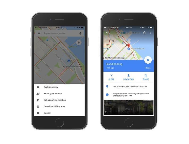
5. ParkPal
Smart Parking Solutions Across Cities
Nothing can ruin a timely arrival like circling around in search of a parking spot. Enter ParkPal—an AI-empowered parking assistant that syncs with Google Maps to provide real-time parking availability and reservation options.
Highlights include:
- Live street-level parking spot tracking.
- Filter options for price, proximity, and availability.
- Pay and reserve directly from the app interface.
Especially useful in densely populated cities, ParkPal ensures your Google Maps directions end with a strategy for smart parking rather than a frustrating search.
6. GeoJournal
A Personal Map-Based Journal
Ever wanted to chronicle your travels with more than just pictures? GeoJournal is a powerful journaling application that lets users log experiences, photos, thoughts, and encounters directly on the map. Integrated with Google Maps, it enables users to preserve travel memories in a rich, geo-tagged format.
Features:
- Add voice notes, images, and even videos to specific locations.
- Build a personal adventure timeline with navigational history.
- Privately archive or publicly share your highlighted routes.
Perfect for digital nomads, photographers, or anyone documenting a meaningful journey, GeoJournal adds a reflective layer to your geographic footprint.
7. SatelliteLens AI
Real-Time Satellite Monitoring and Analysis
Ideal for outdoor adventurers, hikers, and environmentalists, SatelliteLens AI brings highly detailed satellite imaging onto your Google Maps interface. Its AI analysis features help detect changes in vegetation, weather patterns, and terrain over time.
Use it to:
- Identify forest trails and changes in natural landscapes.
- Monitor construction or land development zones.
- Plan off-grid routes with updated satellite imagery.
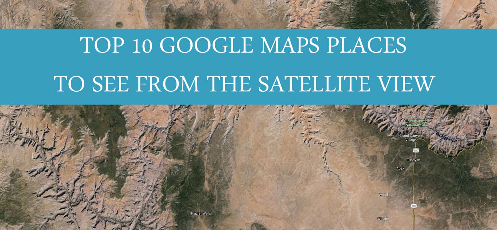
While the Google Maps satellite view is good, SatelliteLens AI supercharges it with data overlays, making it an invaluable resource for nature enthusiasts and researchers alike.
8. LanguagePath
Breaking Barriers with Real-Time Translation
The biggest challenge when navigating a foreign country is often language. LanguagePath is a browser extension and mobile tool that integrates directly with Google Maps, translating place names, signs (via image recognition), and even spoken directions in real time.
Key features include:
- AR translation of road signs and menus by pointing your phone camera.
- Voice assistant for live turn-by-turn translation.
- Supports over 100 languages with offline availability for the top 20.
It’s a lifesaver for solo travelers or digital nomads in unfamiliar territories, ensuring your onward journey is barrier-free—linguistically and otherwise.
Wrap-Up: Rethinking Navigation in 2025
Google Maps remains the centerpiece of digital navigation, but with the rise of AI, AR, and real-time technologies, our interactions with maps are vastly different today. From practical applications like parking assist and accessibility routing to immersive experiences like AR exploration and location-based journaling, these top tools are shaping how we live, travel, and engage with our world.
Whether you’re planning a trip, documenting your journey, navigating urban detail, or simply finding a place to park, these tools will be invaluable companions to your Google Maps app in 2025. Gear up, sync up, and explore smarter than ever before.