Embedding Google Maps widget on your real estate site offers convenience to your clients so they could find you easily. If they like your listing or wish to visit your office, for example, they could easily visit the place or your headquarters.
Keep in mind that not all people have the perseverance to look for your #address on the #map by hand. Thus, if you include #Google #Maps #Widget on your #website, they would no longer need to place in an extra effort. Click To TweetPlus, they could easily remember your location or your listing.
Be Visible on Local Search
Integrating Google Maps with your real estate website will help your site to get found on local search features. As a result, it would boost your site’s online presence and help in marketing your listing.
However, you need to confirm your real estate business with Google Places for Business. In this way, your business will immediately show up on Google Maps.
As you add images, contact details and business hours to the local listing, you will provide users of the said map a better experience of your company when they find your location on the map.
Adding Google Maps widget will also enable your business to attract attention on Google Maps, thereby, motivating clients create testimonials on Google Plus Local, as well as marketing with Adwords.

As you boost your local search visibility, it will be useful for your search engine optimization. Once you claim your business on Google Maps, you get a backlink from a trustworthy source, i.e., Google. Furthermore, it boosts your business’ credibility.
Discover Your Business Location Easily
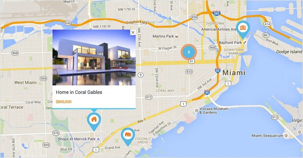
Once you add your business and listing on Google Maps widget, your potential clients could easily find you. However, you have to mark your business’ specific location or the properties you sell on Google Maps.
The precise location on the map will give your website visitors exact location, so they do not have to roam around. Your site visitors could zoom-in or zoom out the map, so they know where they are going.
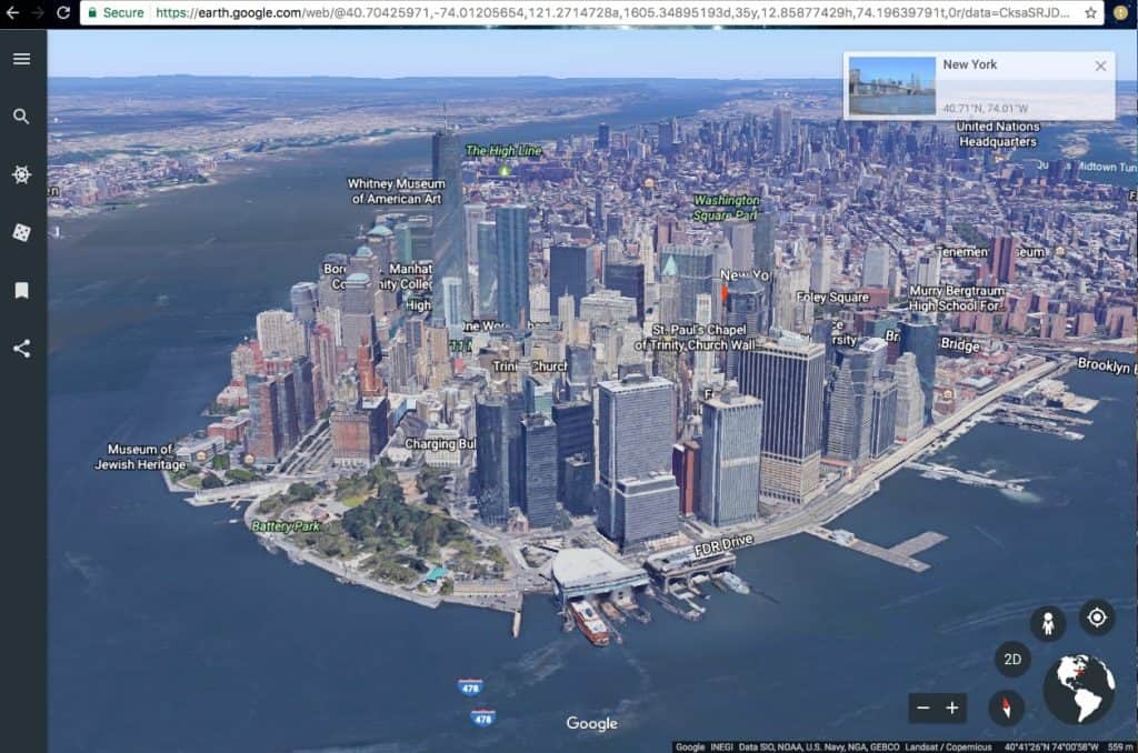
Use It with Google Earth
Google Earth is a separate application. However, it has the same functions as Google Maps but with more functions. Plus, it offers a richer experience.
Real estate developers could use this app to examine constructions with the use of aerial images. Potential clients could also check these images. Furthermore, you could use Google Earth to determine structures in three-dimensional and identify line-of-sight to spot and also view sheds to neighboring parks, etc.
You could use these pieces of details to create remarkable ads as you can highlight sights, facilities, and services for the properties for sale or apartments with utilities included in Chicago, for example.
You can also offer directions to your site visitors. It is an important function if you recognize how to use it. Consider including neighboring locations to share web traffic with potential clients and provide directions to allow your clients to choose the right paths in going to the property.
Taking this approach will enhance site traffic for your real estate investor websites by demonstrating to your clients the accessibility of the property. This encourages them to explore the locations further.
However, make sure that you offer customized maps to your site visitors. One of the downsides of using the WordPress map plugins is that you cannot customize it.
But you can do so with Google Maps. It enables you to adjust the plugin by adding layers, styles, and markers, among others. You could also use it to develop customized maps to show your clients all the lists that they want to check out. Additionally, you could use custom maps that enable you to plan schedules for your showings.
The more details you provide on Google Maps, the better it is for your search ranking. For that reason, Google Maps is not only useful in showing your clients your listing, but it is also beneficial for your online marketing. It lets your potential clients get a first impression of the properties through photos and Google Street View.
It’s good to know that Google Earth can be used to examine constructions of buildings. I’d imagine that accurate and up-to-date real estate drone photography could also be useful. With modern technology, I’d imagine the practice has become more affordable than ever.